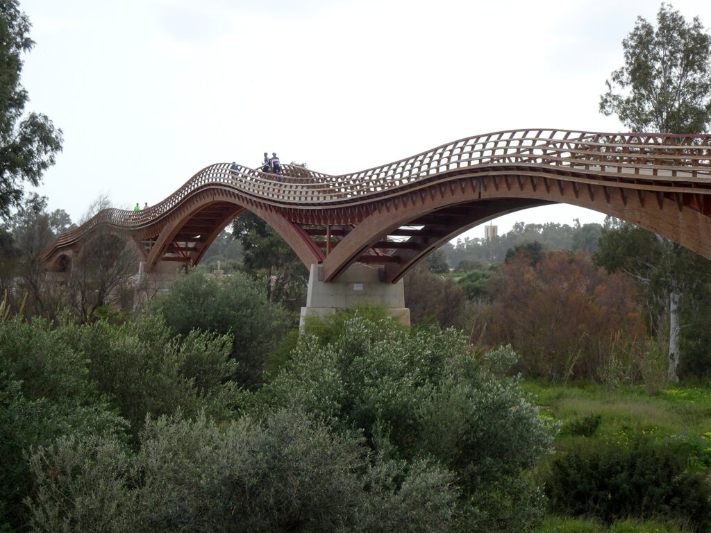
Wooden footbridge crossing the Guadalhorce River and Nature Reserve. At 270 meters, it is reported to be the longest wooden footbridge in Europe. The bridge opened in September 2020, making it possible for people to walk or cycle between Torremolinos and Malaga.
“Wet and wild” weather.
Between the news and the weather gods, we are more than ready to come home.
The weather has not been kind to us lately; cloudy and overcast in Malaga since the beginning of February, “wet and wild” as the weather forecasters put it. A cold front has settled across the country, bringing storms in from the west and north. Towns west of here along the Costa del Sol have been battered with heavy rains and flash floods with some parts getting up to 120 mm in less than 24 hours.
It’s been raining steadily in La Cala del Moral since Friday night, what the weather forecasters are calling “persistent” rain. On the positive side, the reservoirs serving Andalusia are already the highest they’ve been in the last three years with enough water to alleviate the drought.
The Guadalhorce Nature Reserve
Last weekend we drove down the coast to the other side of Malaga city, Malaga oeste (west), to visit the Guadalhorce Nature Reserve and estuary located between Malaga and Torremolinos.
It’s part of my mission to walk as much of the Malaga Coastal Path as possible, one section at a time. The Coastal Path is a 180 km network of seaside promenades, boardwalks and trails stretching along the coast of Malaga from one end of the province to the other. Over the years we’ve been coming to Malaga, we’ve made a point of visiting each of the towns along the coast and walking along their seaside promenades.
The last time we were here, in 2023, we drove down to Estepona to find the start of the trail along the western border. This year I wanted to find the section linking the town of Torremolinos to Malaga which, according to my research, cuts through the Guadalhorce River estuary and nature reserve.
The Guadalhorce is the main river serving the province of Malaga, flowing 154 km from its source in the mountains down to the Mediterranean Sea. The nature reserve was created in 1989 and covers 67 hectares along the Guadalhorce River estuary, a key migratory route for birds flying between Europe and Africa. The estuary is known for its birdwatching, ranked second in Spain for the number of species taking refuge there.
The day we went was overcast and cloudy, but pleasant. We parked in an old industrial neighbourhood that is now being re-developed into residential housing and walked across the sand to the start of the trail leading into the nature park.
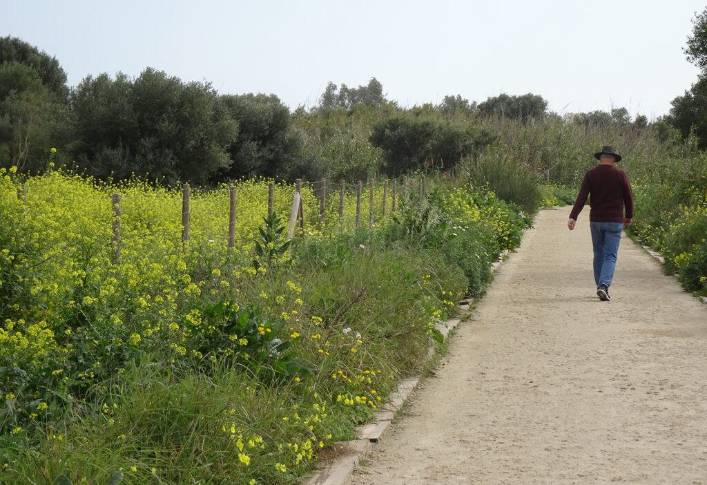
Main trail through the Guadalhorce Nature Reserve, part of the Malaga Coastal Path.
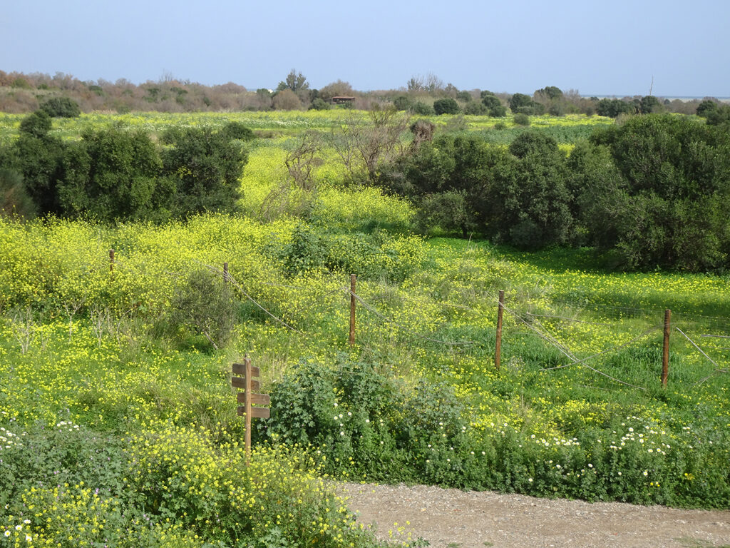
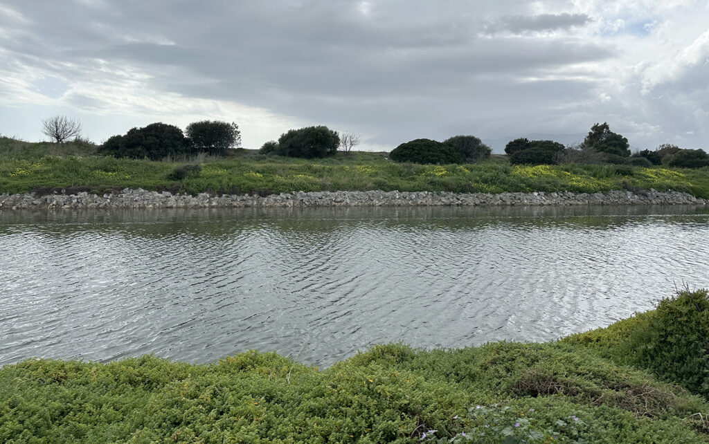
View across the estuary to one of the scenic lookouts. There are at least five “observatorios” or observation decks in the nature park for bird watching, wildlife viewing and picture-taking.
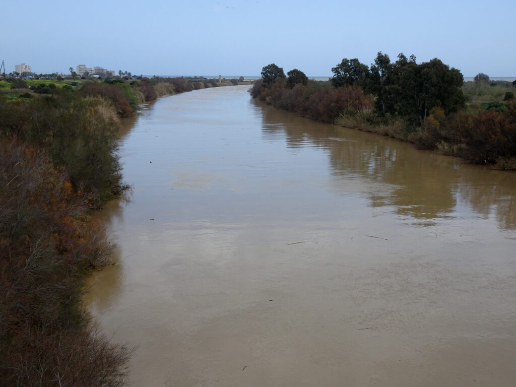
Another one of the channels that was built to help divert the river and minimize flooding. Once the Guadalhorce River reaches the estuary, it is divided into two main channels – Rio Viejo, the old river, and Guadalmar, named after the nearby beach.
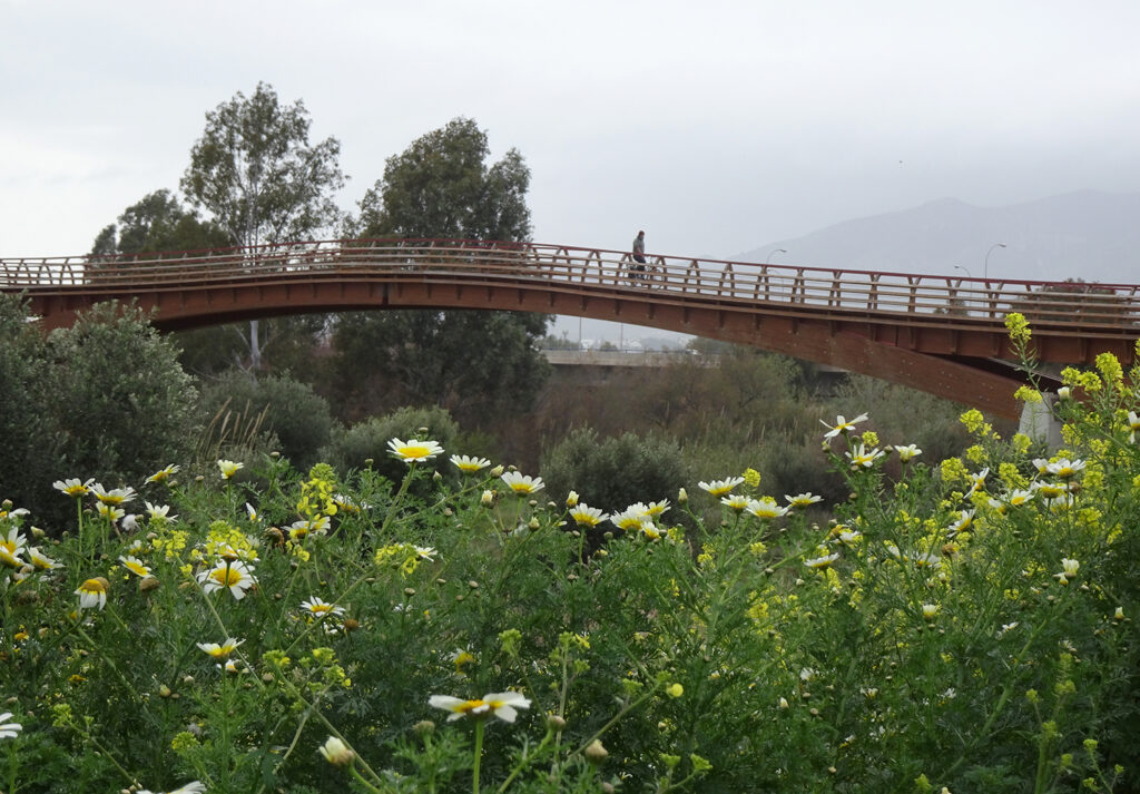
My favorite part of the walk was the wooden bridge which you can see from the main highway. I love the way it curves as it crosses the estuary.
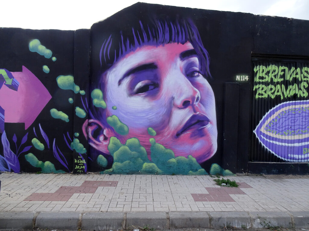
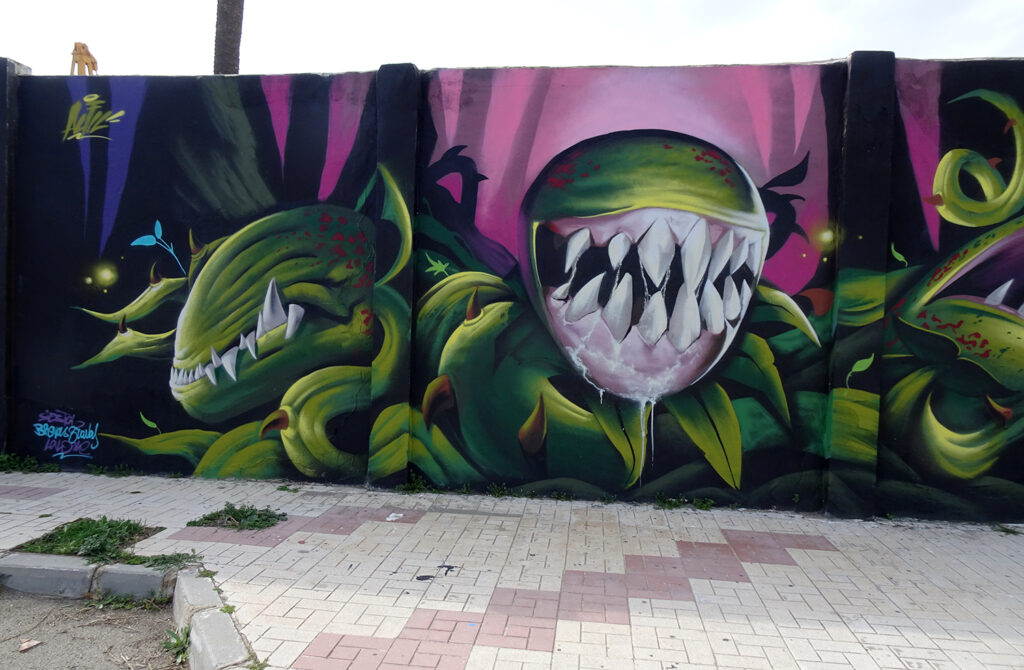
And I couldn’t leave without adding a couple of murals from where we started. There are more than a dozen murals here, painted on the concrete walls, all that remains of the once thriving industrial park.