• Skip to primary navigation
  • Skip to main content

The Oyster River Cafe

  • Home
  • Archives
  • About
  • Contact

Uncategorized

Climbing to the top of Gibraltar

March 5, 2020 By Laurie Jones

One of our more exciting trips this year was climbing to the top of the Rock of Gibraltar via the Mediterranean Steps. It was by far the best way to experience Gibraltar, although I’m not sure we would have been so carefree if we’d known exactly what we were getting into beforehand.

It was only after we had reached the top and were on our way back down that I happened to check the brochure we’d been given and learned that the path we’d taken was the Thrill Seeker route, “perfect for the adrenaline junkie and fitness enthusiast.” Seriously? Adrenaline junkie? Me? Ron?? Definitely glad we didn’t read the brochure before setting out, as “adrenaline junkie” is not the first thing that comes to mind when thinking about myself or Ron.

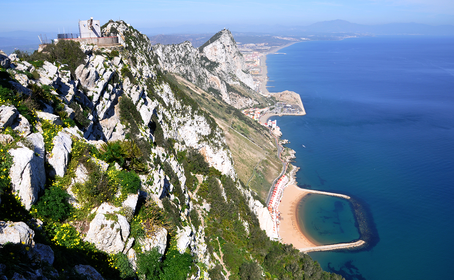
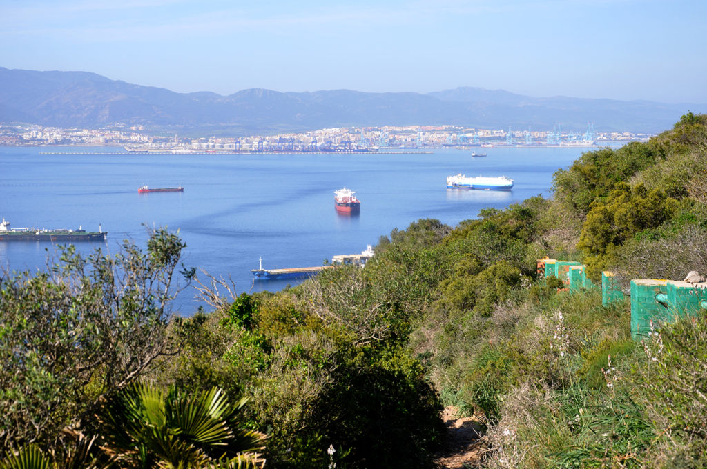
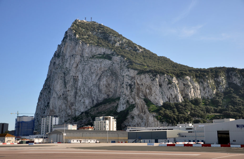
First, a bit of background. The Rock of Gibraltar is a massive limestone promontory located on the southern tip of the Iberian Peninsula, west of Malaga and about an hour and half drive from where we’re staying in La Cala del Moral. It’s 426 m high (1,398 ft), although the highest accessible point is 421 m (1,381 ft). That’s the part we climbed. According to Wikipedia, 40 per cent of the Upper Rock is protected by a nature reserve.

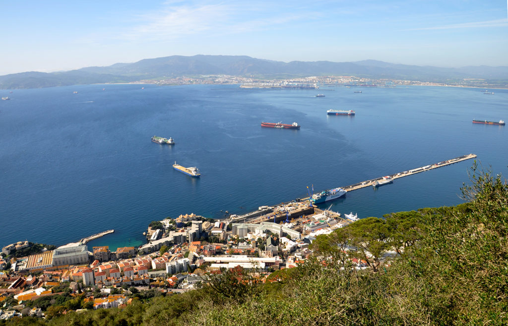
Gibraltar is also a British Overseas Territory and strategic military base guarding the Strait of Gibraltar, the only entrance to the Mediterranean Sea from the Atlantic Ocean, and the narrowest point between Europe and Africa, which is only 14 km away (nine miles).

There are basically three different ways to reach the top of Gibraltar.

  1. Cable car. This is the easiest and, at six minutes per trip, the fastest.
  2. Taxi tour. Also easy and good for groups, as the tour operators try to pack as many people into their vans as possible. Not great if you’re only two.
  3. Walking. There are four main walking routes to the Upper Rock Nature Reserve, including the Mediterranean Steps.

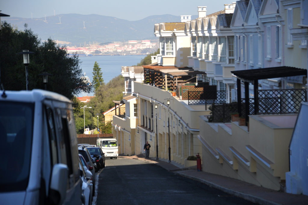
We parked on the Spanish side, in the neighbouring town of La Línea de Concepción, and walked across the border into Gibraltar, and then across the airport runway into town. We then caught one of the local buses (the Number 2, if you’re planning a trip), which dropped us off at the corner of Europa Road and Windmill Hill Road, partway up the mountain.

Looking down Windmill Hill Road towards Europa Road and The Bay of Algeciras.

We then walked another 25 minutes up – yes, up – Windmill Hill Road before finally reaching the start of the Mediterranean Steps. Not very well-marked, either. At one point, worried we’d taken a wrong turn somewhere, we asked a road crew for directions. All they did was gesture to keep going up.

mediterranean steps sign
The start of the Mediterranean Steps at the southern entrance to the Upper Rock Nature Reserve.

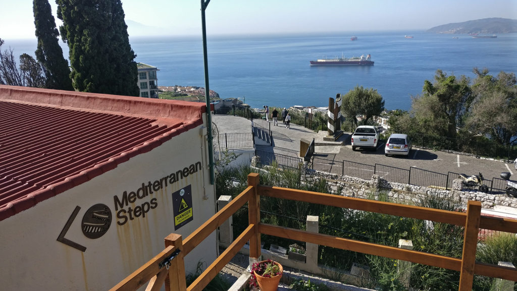
The start of the trail – called Martin’s Path – is fairly gentle as it winds around the southern end of the Rock, although the path itself is narrow and rocky, more like a dry creek bed.

martin's path
Looking back at Algeciras from the start of Martin’s Path leading to the Mediterranean Steps.

At this point, we were thinking “no sweat.” Although we did begin to wonder when and where the famous “steps” were. After climbing steadily for about 20 minutes, Ron began to ask “Are we there yet?” That’s about when the path veered and plunged downward, almost back to sea level before heading up the rock face. Very discouraging, but for those who know us, we would not be daunted. Perseverance is our middle name.

mediterranean steps climbing up the cliff
Section of the Mediterranean Steps climbing up the rock face.

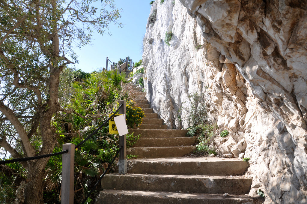
We finally reached the start of the Mediterranean Steps, cut into the rock face, and began our ascent. My mountain-climbing brother, Brian, would have been proud.

A tunnel on the Mediterranean Steps.
Looking down the Mediterranean Steps zigzagging across the face of Gibraltar.
View of the Rock of Gibraltar from partway up the Mediterranean Steps.

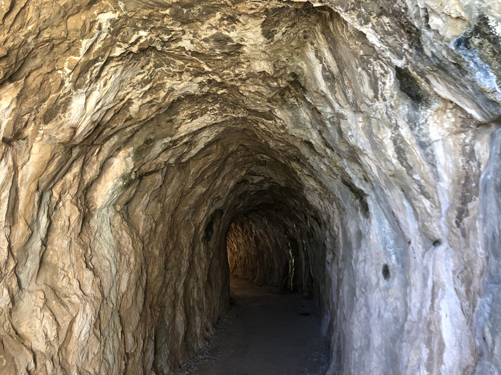
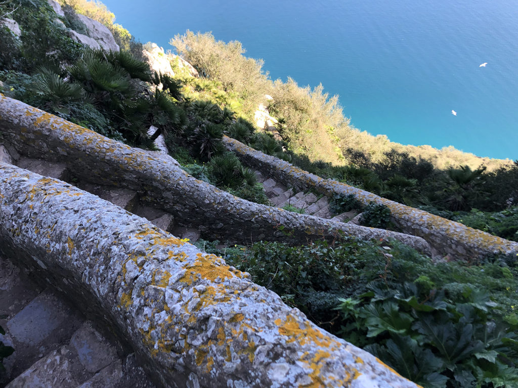
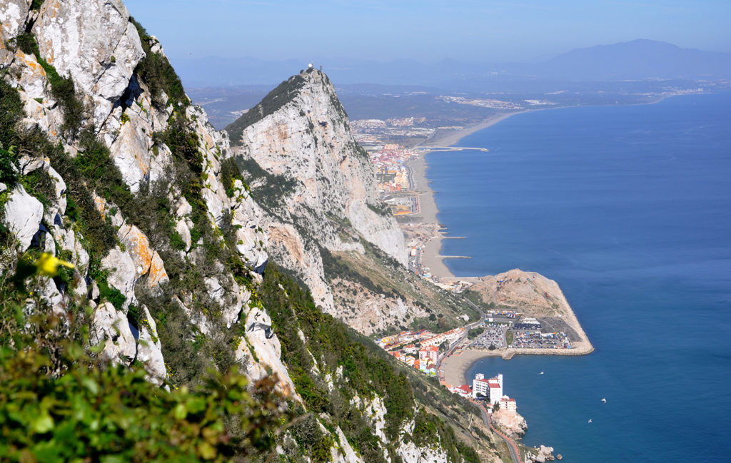
The views from the Mediterranean Steps are breathtaking, and well worth it. Not for the faint of heart, nor those who have a fear of heights. No special equipment necessary, but those rope handrails sure came in handy, as did Ron’s cane. We were taking a break, admiring the view, as a young woman clambered past us on her hands and knees (purple nail polish intact), totally out of breath. She looked up at Ron and said she needed a stick. Ron looked at her and said well, you’re not getting mine. Later, we overheard her boyfriend telling her that if an “old man with a cane” could make it up the Rock, she could too.

View from the top of Gibraltar, looking across the bay to Algeciras.
View of Morocco from the top of Gibraltar.
One of the famous Barbary Macaque monkeys on Gibraltar.
A view of the Rock of Gibraltar from the airport runway.

It was a once in a lifetime experience, and definitely worth it.

Filed Under: Gibraltar, Uncategorized

Greetings from Spain

February 23, 2020 By Laurie Jones

Hi everyone.

Here are some pictures about our winter in Spain. It’s hard to believe that we have been here for more than two months already, only two weeks left before we head back to Canada.

We’re staying in La Cala del Moral, a little community about 15 km east of Málaga on the south coast of Spain. We were here last winter and liked it so much that we booked the same place again this year. I am writing this from my “office” in one of the spare bedrooms on the second floor, looking out across the rooftops to the Mediterranean below.

View of La Cala del Moral from our house on Calle Fragate.

We’ve been pretty lucky with the weather this year, although we did get hit with the outer edges of Storm Gloria at the end of January, a huge weather system that caused quite a bit of damage in Barcelona and brought torrential rains to the coast, including some flooding around Malaga. Other than that, the weather has been pretty good with temperatures around 18℃ (64℉).

I thought I’d start by posting some pictures from around the neighbourhood. One of our favourite walks is along the promenade and coastal path that connects La Cala del Moral with the neighbouring town of Rincon de la Victoria. Each town along the south coast of Spain has its own seawall and is part of the Malaga Coastal Path, a 180 km path that will eventually link all of the communities along the Costa del Sol.

La Cala del Moral seawall looking east towards El Cantal, the bluffs that separate La Cala del Moral from Rincon de la Victoria. It’s winter now and pretty quiet, so we have the beach and promenade mostly to ourselves during the week.
Here’s a view of the promenade in La Cala del Moral on a busy Sunday afternoon when the seawall is packed with people. Weekends are when families come down to the promenade to eat and socialize. Lots of kids and dogs and extended families.
Here’s a view of the coastal path along El Cantal, from the beach in La Cala del Moral.
Looking back at La Cala del Moral from the coastal path on El Cantal. I love this part of the walk, no matter what kind of weather. It’s about
Here’s another view of the El Cantal path and one of the tunnels. There are three tunnels between La Cala del Moral and Rincon de la Victoria, part of an old railroad system that was built in 1908. It operated until 1968 and the tunnels are now used as part of the path for pedestrians and cyclists.
The tunnel from La Cala del Moral to Rincon de la Victoria.
View of Rincon de la Victoria from El Cantal, looking east up the coast.
Sunday afternoon on the promenade in Rincon de la Victoria, outside one of the more popular restaurants. Standing room only on most Sundays as people wait for a table.

So, that’s it for now. Hope you’ve enjoyed this little introduction to our life in La Cala del Moral. Will post more later.

Adiós. Hasta pronto.

Filed Under: La Cala del Moral, Paseo Maritimo, Uncategorized

  • « Go to Previous Page
  • Page 1
  • Page 2

Copyright © 2026 · Oyster River Cafe